BACKGROUND AND INFORMATION FOR PLANNING

THE PEOPLE OF KODIAK ISLAND
The Alutiiq population is part of a continuum of Alaskan maritime people. The Alutiiq, or Sugpiaq people, have inhabited their ancestral homelands for approximately 10,000 years and include four main subsets: Prince William Sound, the lower Kenai Peninsula, the Alaska Peninsula, and the Kodiak Archipelago. Like hundreds of similar Alutiiq settlements along the Gulf of Alaska, the people of the Kodiak Archipelago were skilled mariners who depended on the sea for the necessities of life. The Alutiiq had a bartering economic system, trading goods and services as needed with their neighbors from the Aleutian chain to southeast Alaska. The Alutiiq believed that all things, living or not, possess a spirit, which they honored.
By AD 1200, Alutiiq society flourished in every corner of the Archipelago. The population is estimated by some to have reached 14,000, with as many as 50 winter communities, according to archeological records. Evidence also shows that the Sugpiaq transported a wealth of Kodiak resources like hard black slate, red salmon, bear hides, and spruce root to the mainland—having exchanged these goods for antler, ivory, horn, animal pelts, and exotic stone.
The first outsiders to settle on the island were Russian explorers under Grigory Shelikhov, who founded a Russian settlement on Kodiak Island at Three Saints Bay near the present-day village of Old Harbor.
Shelikhov’s mission was to establish a permanent settlement on Kodiak Island, so as to restrict the inroads of British fur traders and expand the sea otter hunting industry for his company. The Russian-American Company was established by Royal Russian Decree in 1799, and it was headed by Alexander Baranov. Baranov led the company for 19 years, building a lucrative fur trading enterprise trapping and selling sea otter pelts. But by the middle of the 19th century, the sea otter populations were driven almost to extinction.
He and his men, equipped with modern artillery, defeated the Alutiiq people in a series of battles and subdued the islanders. Russian colonization had a devastating effect on the local Native population. By the time Alaska became a US Territory in 1867, the Koniag Region Alutiiq people had almost disappeared as a viable culture. Their history and heritage were retained by a handful of families in each community.
The culture is currently undergoing a historic revitalization that includes culture camps, language, and internationally recognized Alutiiq Museum.

PHYSICAL GEOGRAPHY
The island group known as the Kodiak Archipelago is situated on the western side of the Gulf of Alaska. The Kodiak Archipelago and a portion of the Alaska Peninsula are within the Kodiak Island Borough, or Koniag Region. The City of Kodiak, the main port of entry to the Borough and its environs, is 252 air miles south and west of Anchorage (a 45-minute flight), accessible only by plane or boat.
The Borough encompasses a 29,000 square mile area, which includes approximately 6,500 square miles of land, including lakes and rivers, approximately 23,000 square miles of coastal waters, and 5,500 miles of shoreline. The Archipelago contains 162 named islands and nearly 1,500 unnamed islands, accounting for approximately 74% of the total Borough land area.
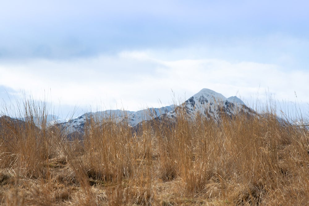
Kodiak Archipelago consists primarily of mountainous terrain, the tallest peak being Koniag at 4,500 feet on Kodiak Island. With the exception of the lowlands and broad valleys of the southwestern portion of Kodiak Island, the Archipelago coastline is rocky and rugged.
Kodiak Island is the largest island in the Archipelago and is the second largest island in the United States. The north and east sides of Kodiak Island are heavily forested. Wetlands, grasslands, and brush dominate the Island’s south end. Commercial stands of timber, primarily Sitka Spruce, exist on the north end of Kodiak Island, as well as Afognak Island. Kodiak Island has numerous deep, ice-free bays that provide sheltered anchorage for boats. The southwestern two-thirds of the island, like much of the Kodiak Archipelago, is part of Kodiak National Wildlife Refuge.
Kodiak Island is home to eight communities: The City of Kodiak, and the remote communities of Akhiok, Karluk, Larsen Bay, Old Harbor, Ouzinkie, Port Lions, and Chiniak. Within these eight communities, Kodiak Island is home to ten federally recognized Tribes. There are no roads connecting the hub city of Kodiak with the outlying villages, with the exception of Chiniak. Village residents rely on transportation by boat or commercial airlines for travel in and out of their communities. The Alaska Marine Highway is a vital link between mainland Alaska, the Kodiak road system, and the three communities (Old Harbor, Ouzinkie and Port Lions) that receive service.
The climate of Kodiak Island is characterized by moderately heavy precipitation and cool temperatures with frequent high clouds, fog, and high winds. These weather patterns oftentimes result in restricted travel. High winds and icing are frequent during the winter, with storm winds produced by systems in the Gulf of Alaska that often sustain speeds from 50 to 75 knots.
However, Kodiak’s climate is favorable for over three hundred species of plants, many of which were used by inhabitants for food, medicine, and shelter. The deep fjords of Kodiak Island provide an abundant habitat for fish and marine mammals. Five species of salmon, herring, and halibut are all found in Kodiak Island waters, providing commercial, subsistence, and sports fishing resources.
BOROUGH LANDS
The Kodiak Island Borough was provided with roughly 56,500 acres of land within the Kodiak Archipelago from the State upon incorporation. Most of this land was originally obtained and selected under municipal entitlement act from the State of Alaska; the configuration of other parcels is the result of land trades with the State. Over 50 percent of Borough land is located on Shuyak Island and Raspberry Island; Ugak Bay and Hidden Basin also include numerous pockets that total a sizeable portion of Borough land acreage. Lease and disposal of Borough lands are subject to approval by the Borough Assembly. The Kodiak Island Borough zoning ordinance contains 18 zoning districts: Watershed (W); Wildlife Habitat (WH), Natural Use Lands (NU); Conservation (C); Rural Development (RD); Rural Residential (RR); Rural Residential One (RR1); Rural Residential Two (RR2); Single Family Residential (R1); Two Family Residential (R2); Multi-Family Residential (R3); Business (B); Rural Neighborhood Commercial (RNC); Urban Neighborhood Commercial (UNC); Retail Business (RB); Light Industrial (LI); Industrial (I); and Public Use Lands (PL). A new zoning scheme is in the works. Recreational land use includes 11 municipal parks totaling 60 acres in size.
STATE LANDS
The most significant State lands in the Borough are the region’s vast tidelands. The State owns a significant amount of upland area in the Borough. Most state uplands are in the northeast part of the Borough near the City of Kodiak, and south around Ugak Bay to Dangerous Cape.
The Alaska Department of Natural Resources (DNR) manages most state land in the Borough, though few areas have had management authority transferred to other State agencies. The Alaska Department of Transportation and Public Facilities manage roads and airport facilities, the Alaska Department of Fish and Game (ADF&G) manages the Tugidak Island Critical Habitat Area, and the Division of State Parks within DNR manages state park lands. State parks accessible by road include: Fort Abercrombie, Buskin River, and Pasagshak State Recreation Sites. A large portion of Shuyak Island is an undeveloped State park accessible only by water or air. The newest State park in the Borough is located on the northern coast of Afognak Island. In total, 5 state parks throughout Kodiak Island comprise 56,448 acres.
FEDERAL LANDS
Much of the Borough contains land managed by federal authorities. The major federal land owner on Kodiak Island is the U.S. Fish and Wildlife Service (USFWS). USFWS manages the Kodiak National Wildlife Refuge (KNWR), which comprises 1.8 million acres of the archipelago, a portion of the Becharof and Alaska Peninsula National Wildlife Refuge (APNWR), and the Alaska Maritime National Wildlife Refuge (AMNWR). KNWR is managed primarily as habitat for the Kodiak Brown Bear, the largest bear in the world. The USFWS is the largest single land manager in the Borough. The refuges are managed as multiple use areas and allow a wide variety of purposes that do not interfere with the primary objective of each refuge. The Borough boundary on the west, across Shelikof Strait, includes a portion of Katmai National Park managed by the Department of the Interior, National Park Service, The U.S. Coast Guard (USCG), and the Department of Transportation. The USCG Support Center Kodiak, which is located near the Kodiak urban area, contains over 21,000 acres.
A portion of the scattered small rural parcels in the Borough are federal trust lands. Except for Native Allotments and Federal Town site lots, no other federal trust lands, such as Indian reservations, exist in the Borough. These parcels are held in trust by the federal government in the name of the owner. The activities on the parcel and any transfer of title must be approved by the Bureau of Indian Affairs (BIA). Since they are federal trust lands, the parcels are exempt from most local and state regulations, as well as taxation, until ownership is transferred. Federal environmental laws such as NEPA and the Clean Air and Water Acts do apply.
PRIVATE LANDS
The greatest growth among land ownership categories in the Borough has been among the sole proprietors of privately held land. Most of the lands selected by the Native regional corporation, Koniag, and the village corporations have been transferred for management or patented to the corporations. Over 750,000 acres of land have been transferred to these private corporations. This amounts to about 17 percent of the total land mass of the Borough. Much of this acreage, such as that on Afognak Island, was selected for timber resources or other development potential. However, some of this acreage was selected from within Wildlife Refuges and contains areas with high habitat values for fish and wildlife. Over the past several years, money from the Exxon Valdez Oil Spill settlement has allowed the federal government to repurchase much of this land. The surface estate to former Wildlife Refuge lands is subject to regulation to ensure its protection in a manner that will not materially impair the values for which the refuge was established and the subsurface estate (mineral rights) to such land was retained by the federal government. Except for lands previously part of a Wildlife Refuge, the subsurface estate of all Native lands is owned by Koniag, Inc.
ALASKA NATIVE CLAIMS SETTLEMENT ACT (ANCSA) LANDS
Collectively, as the largest private land owners’ in the archipelago, the ANCSA corporations have the greatest potential for both resource development and other development opportunities. ANCSA lands in the region have been developed in a variety of ways including: logging; tourism facilities and activities; residential real estate development; federal and state land acquisition through the Exxon Valdez Oil Spill Council habitat restoration activities; mining; and gravel and rock sales.
Koniag, Inc., one of the thirteen Alaska Native Regional Corporations created under ANCSA, was incorporated in Alaska on June 23, 1972 by the Alutiiq People of the Kodiak Archipelago. At incorporation, Koniag, Inc. enrolled about 3,400 Alaska Native shareholders. ANCSA regional and village corporations selected land in and around existing Native villages in the State in proportion to their enrolled populations. The regional and village corporations are now owned by Alaska Native people through privately owned shares of corporation stock.
POPULATION
The population of the Kodiak Island Borough, according to the 2022 estimates from the Alaska Department of Commerce, Community and Economic Development, is 12,832 including the outlying villages. The total population of the Kodiak Archipelago villages is 602. The Kodiak Island Borough appears to be experiencing a slow-but-long- term shift in racial and ethnic distribution. The only groups which saw an increase were the ‘Asian alone,’ showing a 4% increase and ‘Alaska Native and American Indian alone’ with an increase from 13% to 14% from 2010 to 2020. Conversely, the proportions for ‘White alone’ decreased from 55% in 2010 to 50% in 2020. The ‘Black or African American alone’ and ‘Native Hawaiian and Other Pacific Island alone’ both saw very small to no changes, on the order of 1%. Accumulatively, the village populations were 77% Alaska Native/American Indian, 18% Caucasian, 5% two or more races, and less than 1% of both Asian/Pacific Islander, Asian alone or African American. These numbers reflect the most current demographic information, based on the 2020 census.
2010 Census 2020 Census 2022 Estimates
City of Kodiak 6,130 5,581 5,396
Akhiok 71 63 65
Chiniak 47 61 53
Karluk 37 27 28
Larsen Bay 87 34 28
Old Harbor 218 216 200
Ouzinkie 161 109 116
Port Lions 194 170 165
Kodiak Station 1,301 1,673 1,543
*Women’s Bay – 743 766
*Mill Bay – 4,216 4,244
Other Places 5,346 208 228
Total Borough 13,592 13,101 12,832

